

Dazed. My first hike of the year dawned at a brisk 10
degrees, and I had on as many layers as physically possible. I had survived the
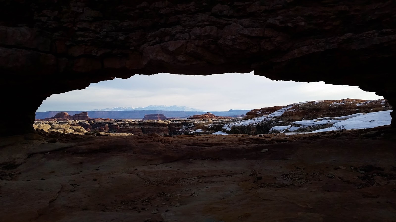
night in my tent nestled deep within the Needles District of Canyonlands
National Park, and the breaking of dawn meant I was ready to get on the trail.
My intention was to hike Squaw Canyon to Lost Canyon and loop back through the
Needles, roughly an eight mile hike that should have been no problem, even with
the altitude difference between the Colorado Plateau and back home in East
Texas. I left my car in the frosty shade of the Elephant Hill parking lot and
set off with mounting excitement at being back among the Needles. Riding the
high of being back at my favorite place on Earth, I barley felt the cold and
was soon shedding layers as the sun rose and began warming the rusty towers
surrounding me.

I kept up a good pace as I wove through the Needles, coming
to my first trail junction and beginning my trek into Squaw Canyon.
Jaw-dropping vistas sprinkled with snow spread out around and below me as I
stood at the top of the canyon, and I stopped for a full five minutes just to
stare at it all. My first hesitation confronted me when I came across a
north-facing descent that was packed with ice and snow, and I could see where
other hikers had slipped and slid down the slope to the three foot drop off. I
knew it was going to be a bitch if I had to climb back up it, but pressed
forward anyway. Crouching low to keep my center of gravity down, I inched
across the hard-packed snow, and when the incline became too steep, gave up,
sat on my butt and slid down the ice ramp, landing with a thud at the bottom of
the drop off. Shaking it off, I kept going.

It wasn’t until about a mile after that descent that I began
to feel like I wasn’t on the right trail. My GPS told me I was going one way
but the map I had with me had the trail I wanted to be on going off in a
different direction. It was only when my GPS showed that I wasn’t even on a
trail, when there was clearly a cairn-marked trail beneath my boots, that I
realized I was not on the trail
through Squaw Canyon, and that I actually had no idea what trail I was on. At
about the same time, I found a sunny rock to sit on and pulled out my map to
try to figure out where I’d gone wrong. After some length of time I figured out
I was on the trail through Big Spring Canyon, and that this trail would take me
back to the same campground I had stayed in the night before. It was either
press on, on the wrong trail, or try to backtrack to the one I had intended to
hike. Remembering the ice slide and how much of a pain it would be to climb
back up (if it was even possible), I decided to just stay on the trail I was on
and hope for the best.
I still deliberated with myself about whether or not I
should turn around, but after I slid down yet another north-facing slope, this
time one without a hope of climbing back up, I gave up and committed to the new
trail. I began to develop a headache, which I attributed to altitude and stress
from being derailed from my intended hike. I kept going, a little slower,
perhaps, but still moving. Once I reached the campground road, I knew my hike
was over, but still had miles to walk on road to get back to my car. It was
around that time that my headache became worse and I began to feel sick. Really
sick. I trudged roughly four miles on the road, and for the first time ever
half-hoped someone would drive by and give me a lift to my car. I didn’t see
anybody, though, and all but collapsed into my car when I finally arrived. My
map-reading mistake had cost me in miles and time, and my eight mile hike
turned into nearly ten miles and an extra hour. By the time I arrived at my
car, my head was spinning and I was so sick I could hardly move. All in all, I
don’t think I’ll be making that mistake again. Next time, I’ll double check the
map.

No comments:
Post a Comment