Showing posts with label Historical. Show all posts

Thursday, June 18, 2020

A Snapshot and The Scoop: Silver Bell Mine


The Silver Bell Mine, pictured above, is one of a few old prospecting locations scattered throughout Joshua Tree National Park. Once used to extract gold, lead, and copper from the surrounding desert mountains, the mine reached its peak in 1917 and was eventually abandoned in the 1960's. Reports from the height of gold fever showed the mine had low gold value, but rather high copper value - worth about $90 a ton.

Tuesday, June 2, 2020

A Snapshot and The Scoop: The Ohio & Erie Canal, An East Coast Epic Story


No longer in use, the remnants of the Ohio & Erie Canal preserved in Cuyahoga Valley National Park, is an overgrown yet potent reminder of America's past. Once the main mode of the transportation of goods, livestock, and sometimes even people, canals throughout the upper Midwest and Great Lakes regions served their purpose in providing safe, accessible ways to move supplies in controllable fashion, without having to worry about the pitfalls or meandering direction of the local rivers. Locks strategically placed in intervals helped keep the canal levels steady, and special boats built to fit exactly within the confines of the narrow canal were towed along by mule teams on dry ground. It's rather startling to see how ingenious people can be if given enough time and motivation, and the canal system still around today stands in as proof of human tenacity.

Tuesday, May 26, 2020

A Snapshot and The Scoop: A Spot of Light, An East Coast Epic Story


Imagine going into a cave with a small, flickering source of light that may or may not burn out and leave you to scramble in the dark, hoping to find the way out . . . or else. Prehistoric Indians did just that as they explored Mammoth Cave, located in central Kentucky in the foothills of the Appalachian Mountains. They used the cave for shelter and as a source for minerals, gathering reeds from the nearby river, bundling them together, and hoping to have light for an hour or so. Of course, they brought multiple torches with them, but still! I love visiting caves, but I can't imagine going through one without a guaranteed source of light. Props to them!

Tuesday, May 12, 2020

A Snapshot and The Scoop: Presque Isle, An East Coast Epic Story


My solo East Coast adventure last year took me to three of the five Great Lakes - Lake Michigan, Lake Erie, and Lake Ontario. My stop on Lake Erie was at Presque Isle State Park, a little spit of land featuring a gorgeous drive, bays and beaches, and an old lighthouse with its own courtyard. I arrived after closing time so was unable to tour the lighthouse, but greatly enjoyed my drive around the peninsula, making sure to get out a couple times to wet my toes in the lake and enjoy the breeze. I saw people boating, paddle boarding, kayaking, and swimming, which of course made me wish I'd brought my swimsuit along so I could go for a dip without ruining one of the few changes of clothes I had with me. There's always next time!

Thursday, April 30, 2020

A Snapshot and the Scoop: "Action!"


This may look like an ancient ruin, but it was actually part of a movie set built in 1965 for "The Professionals." Recognized for it's incredibly geologic formations, many movies and commercials are filmed within the Valley of Fire State Park boundaries, which has caused park rangers to have to carefully manage who gets permits to film so that no lasting environmental impacts are made. I won't lie here, I rarely watch movies and have not seen any of the ones filmed in the park, but just the physical reminder that things like this exist is pretty neat!

Thursday, April 23, 2020

A Snapshot and The Scoop: Reminders of the Past


Built by the CCC during the Great Depression, three cabins sit against a stone cliff overlooking the part of Valley of Fire State Park. The cabins are made from the same sandstone that's found in the rest of the park, and at first glance it's easy to miss them, which is sort of the point. Used by campers and travelers for years, the cabins now stand as empty reminders of what the CCC accomplished throughout the park, the state of Nevada, and the rest of the country as citizens struggled during the depression.

Thursday, April 9, 2020

A Snapshot and The Scoop: Mouse's Tank


In the desert, little shaded pockets of sandstone, usually located in the bottom of canyons, that are filled with perennial water are called "tanks". These tanks are life-saving resources for desert animals and humans alike, such as the Southern Paiute Indian this particular tank located in Valley of Fire State Park in Nevada is named after. "Little Mouse" was a fugitive accused of killing two prospectors, and used this water source while hiding from the law in the late 1800s. Though he was eventually caught and killed, Little Mouse survived for far longer than anyone would have thought in this dry desert, all because he found this tank of water. Today, desert-dwelling animals such as lizards, snakes, mice, and big horn sheep use this water source and others like it to survive where there are no rivers or lakes, and where rain is scarce.

Tuesday, January 21, 2020

A Snapshot and The Scoop: Moonshine Questions, An East Coast Epic Story


Oh, the stereotypes of an abandoned moonshine still in the swamps of the deep south. For real though, spotting this gem of broken, sagging plywood while wandering the boardwalk at Congaree National Park brought the past to life in ways that just reading about the history of prohibition could not have achieved. How many people used this little still? Why did they choose a flood plain, swamped with water for most of the year, as a hiding place? What did they do in their day jobs, if any? Were they discovered, leading to the still being abandoned, or did prohibition finally end? So many questions, likely never to be answered. It's little details like this that make my travels so enriching, and keep me coming back for more.

Tuesday, July 9, 2019

A Snapshot and The Scoop: Tuff


In all my years of traveling, all my miles in the car and on foot, I have never been tired of saying "that's something I haven't seen before." The tuff cliffs comprising the Frijoles Canyon of Bandelier National Monument are certainly in this category. Tuff is compressed volcanic ash, deposited in this area by two enormous volcanic eruptions more than a million years ago. Over time erosion carved canyons and mesas into the land, exposing tuff in places like the cliffs picture above. It's density depends on how quickly it cooled, and tuff can range from very hard to incredibly crumbly. The cliffs of Bandelier National Monument err on the side of crumbly, which, in addition to the perennial water source, attracted ancient Pueblo people to populate the arid land. The bigger caves in the cliffs above aren't all natural - most of them have been enlarged by hand to provide living spaces for the ancient dwellers, and most of the post-holes pecked into the walls to provide roofs over the shelters still exist. Look closely at the picture and you can see masonry in the bottom third, leading up the slope to the cliff, as more evidence of ancient civilization. I truly hope I never get tired of seeing new things.

Thursday, May 30, 2019

A Snapshot and The Scoop: Hohokam Petroglyphs


Nestled within the acres of Saguaro National Park are several sites of thousand-year-old petroglyphs, pecked into the dark desert rocks by prehistoric hunter-gatherers. While no one knows what these symbols mean, whether they are spiritual, directions, or graffiti, the fact that someone once took the time to chisel designs into rock, and that these designs have endured a thousand years of weathering and human fascination, speaks to both the determination of those who put them there and the arid desert climate. Abstract designs are typical of the Hohokam petroglyphs, far more prevalent than life forms, with an emphasis on circular and spiral designs. I don't know about you, but that's a motif I can get behind!

Thursday, May 16, 2019

A Snapshot and The Scoop: Barrel Cactus


I will never get tired of cacti and their multitude of uses (plus they look awesome and are incredibly easy to care for). This neat plant, for example, has hooked spines that can be used as sewing needles and fish hooks! I mean for real, multi-purpose items are kind of like the holy grail of hiking and backpacking, and by extension surviving in harsh desert environments like the ancient southwestern Native Americans did. Not only is this plant useful in more than one way, it's pleat-like folds swell to soak up water during rare rain showers, making it a barrel, indeed!

Thursday, May 9, 2019

A Snapshot and The Scoop: Agave


It's amazing how many desert plants can provide nutrients, especially for humans. Yes, while agave is currently featured in the latest health fad, agave has actually been used as a food source for humans dwelling in the American Southwest for hundreds of years. Their "hearts", or the center of the flower stalk, can be roasted and eaten, in addition to the nectar used to make a sugar substitute. It was so neat to see this spiky yucca-like plant in its native range while wandering around the Arizona deserts over the winter, and I kind of can't quit daydreaming about going back sometime soon.

Thursday, December 27, 2018

A Snapshot and The Scoop: Agate Fossil Beds


Sitting deep in an out of the way corner of western Nebraska, nestled between rolling sandhills and towering bluffs, lies Agate Fossil Beds National Monument. A quarry boasting bone and ash deposits from prehistoric times, Agate Fossil Beds was a stop along my dad's and my Father-Daughter trip this past winter. I somehow convinced Dad to make the walk along a windswept prairie path, passing over a baby Niobrara River, to the hills where the most concentration of fossils have been found. We were the only visitors around, so close to closing time, and we had the views and the trail all to ourselves. We took our time walking the paved path around the hills, searching for a hint of fossilized bone sticking out of the earth. We didn't see anything we recognized, but that's not to say there wasn't something right under our noses and we didn't know. It was a bit chilly, especially for me since my blood has thinned from living in the south for so long, and we didn't exactly spend hours outside. The walk was still nice, though, and the quite of the prairie around us reminded me why I like western Nebraksa.

Leave me a comment and tell me if you've ever been to this small National Monument. What did you think of it?

Thursday, December 20, 2018

A Snapshot and The Scoop: The Night We Confirmed I'm A Wimp


It looks fairly nondescript, doesn't it? An old farmstead, a historical site, at Buffalo National River in northern Arkansas, right along the Buffalo River Trail that Torrey and I were busy finishing up this year. We passed by Erbie Historical Site in the afternoon, after something like fifteen miles of hiking with our packs on. We still stopped to check out the homestead, peeking into the old house, the barn, the chicken shed, and other smaller buildings on the property. It was cool, neat, a bit of history. Then we moved on, eager to make it to our car and the luxury of camping for the night. Until, that is, we needed one last run to the bathroom before hitting the sack. We were cold and lazy, and yeah ok I really didn't want to walk from our campsite all the way to the other side of the campground in the pitch black night where not even the stars were shining. So I convinced Torrey to drive us there. And boy did I regret it, because no sooner had we finished up at the outhouse than Torrey decided it would be fun to go for a late night drive along a forest service road. To check out that old farmstead. Did I mention it was so dark that there weren't even stars out? So me being me and hating being scared, I did the only practical thing I could aside from voicing my vehement disapproval (which fell on deaf ears anyway): I covered my eyes. I straight up refused to look, gloved fingers pressing into my watering eyes so hard I was seeing bursts of white light erupt behind my eyelids. The bumpy, twisting forest road felt like a lot further than the mile or whatever it actually is, and at the end of it when Torrey turned her headlights on bright to illuminate the farmstead in all its midnight glory, I still refused to look. Her commentary didn't help, saying things like "Oooh this is creepy. Why did we do this? This is terrifying! Why did I think this would be a good idea?" And I refused to even peek, despite her goading. And when she had sufficiently freaked herself out enough to turn around and leave, Torrey missed the turn for our campground, essentially forcing me to open my eyes long enough to help her get us back to our site. My gloves damp and tears still leaking down my face (because apparently that's my reaction to fear, and what a wonderful reaction it is, eyes welling up like a freaking garden hose), I had to pay attention to this stupid forest service road illuminated only as far as the headlights could reach past every twist and turn, convinced we were going to round a corner and find the ghost of the farmstead's last owner in our path. Did I mention I hate being scared? I make up too many stories in my head for things like this to make me comfortable. Once we finally returned to the safety of our campsite we got into our bags, Torrey mumbling about how it had been a bad idea to go and how she wouldn't be able to sleep. I may or may not have been a little smug when I told her I wouldn't have a problem sleeping. I didn't look, after all.

Sunday, December 16, 2018

Fifth Annual Father-Daughter Trip


Relaxed. Starting back in 2014, along with my desire to travel, my dad and I began taking Father-Daughter trips once a year. Sometimes we were accompanied by my sister and others, but at the core it was for us. Dad has a goal of visiting each of the five hundred plus historical markers in the state of Nebraska scattered throughout ninety-three counties, and every time we get a chance we hit the road on our quest to see them all. I thought maybe moving to Texas might mean the end of our travels, but I've been pleasantly surprised to find that's not the case. This past spring (ok, late winter in Nebraska) Dad and I took to the bluff country in extreme western Nebraska, searching for historical markers among the state's national monuments dedicated to the Great Western Trails.


Bluff country butts up agains the sandhills, and for anyone who thinks Nebraska is flat you're wrong. Well, partially wrong. Yes, Nebraska is flat if you keep to the I-80 corridor, but if you get off the interstate and head north you'll find a landscape of rolling prairie and sandstone bluffs that rise out of the grasses like the backs of giant sea creatures. The sandhills are my favorite place to visit in Nebraska, and I was more than happy to go with Dad as we scoured them for historical markers. Our quest brought us down some pretty obscure Nebraskan roads to some pretty obscure Nebraskan Monuments, but hey, "Honestly, it's not for everyone."


What's not for everyone? What about the fossil quarries laden with ice age bone and ash deposits at Agate Fossil Beds National Monument? What about the Oregon and California Trails that pass through the state's Scotts Bluff National Monument, rich with pioneering history? Don't get me wrong, I got out of Nebraska as soon as I had the chance because I always knew I would leave the state, but that doesn't mean I don't like to visit. And not just because my family is there. Nebraska boasts a neat assortment of state and historical parks, and a small handful of national monuments, that are well worth the effort of leaving the interstate to go explore. And that's exactly what Dad and I do every time we get a few days to run away to continue tracking down historical markers.


We might have cheated a little bit and drove up the 800 foot tall Scotts Bluff instead of hiking the trail to the top, but on a chilly winter/spring day, driving seemed like the more prudent option. The views of the prairie grasses and the ridge of bluffs receeding past the Wyoming border into the distance are something you wouldn't get if Nebraska really was flat, and I couldn't help but be a little awed at what lay around us. As the gateway to the more rugged mountain country in Wyoming, western Nebraska was a stop for many on the pioneer trails as they prepared for mountain conditions, and as such their trails, camps, and forts litter the area around the bluffs. The bluffs themselves were used as landmarks, breaking up the monotony of the plains.


One such landmark, a rather famous one if you were raised in Nebraska, is Chimney Rock. In my experince with my travels just about every state has a "Chimney Rock", but there is only one true rendition of this rock, and it resides in western Nebraksa. Dad's and my fifth Father-Daughter trip wouldn't have been complete without a stop at the state historical park protecting Chimney Rock, as well as no less than four historical markers near its location. Chimney Rock wasn't our last marker on our trip, but Dad and I began heading home after our visit to the park. I think we only have two or three areas of historical markers left to get, and then we'll have to find something else to do for our annual trips!


Thursday, December 13, 2018

A Snapshot and The Scoop: That One Time I Noped Out


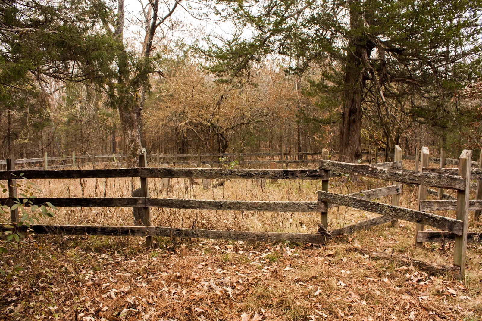
I take a lot of pride in travelling, hiking, and camping. Especially alone. However, in order for me to be able to continue enjoying myself there are a couple of ground rules I stick to that allow me to sleep soundly at night when I'm by myself in the backcountry of who-knows-where, and the number one rule is to avoid scary things. Mainly, this means I avoid scary movies like the plague. If someone turns on a scary movie, I leave the room, and if I can't leave the room I put in headphones or go to sleep. I definitely do not need the mental images of the main actors getting chased down by some creepy guy in a mask in the middle of a dark forest. Can you blame me? Another rule I have is to not go poking around creepy abandoned places, like an old farmstead or a random cemetery right off the side of the trail. Like the one in the picture above. Torrey and I came across this cemetery on our final day of hiking the Buffalo River Trail in northern Arkansas, shortly after we began the day's trek. Torrey likes historic sites like this, so I humored her by checking out the gravestones overgrown by the flora of the forest. That is, I went with her until I took a step and felt the ground shift under my feet. In all reality it is likely a grave cover had become overgrown with grass and hidden by the fallen leaves, and my weight shifted it just enough to make it wobble, but one thing led to another and then I was imagining zombies popping up out of the ground and chasing Torrey and I through the backwoods of Arkansas where we hadn't seen a single person on the trail since we'd began two days before and nobody would be around to witness our gruesome deaths. Yeah, I might have let my imagination and my minimal experience with scary movies get the better of me, but I was out of that cemetery so fast I'm pretty sure I left a puff of Natasha-shaped dust in my wake. I was doing that thing I do when I get scared where I tear up and giggle madly as I retreated to a distance that was by no means safe but at least gave me a headstart over Torrey if my nightmares came to life. At least her and I have been friends long enough for her to not hold it against me. It wasn't long before I convinced her I needed to move along for my sanity's sake, and we left the little cemetery behind. I may or may not have been keeping an ear out for the groans and rustling leaves that would signal we were being followed.

Tuesday, December 4, 2018

A Snapshot and The Scoop: Government Ditch


If you ever get a chance to take a boat tour on Caddo Lake in East Texas, do it! I had the opportunity to go this summer, and it was fantastic! Our boat guide was incredibly knowledgeable, and took us on a route through the swampy lake that he clearly knew by heart. The "ditch" pictured above was cleared out by the government in order to make room for steam engines, which at that time were the primary mode of transporting goods, and involved tearing out the cypress trees and dredging the canal to make it deep enough to get a boat through. A lot of Caddo Lake is a mixture of shallow waters and sopping wet land that rises just a few inches above the waterline, surrounded by the world's largest cypress forest. At any given time the land could be submerged or truly dry, depending on the water levels of the lake. Caddo's history is rich, and I wouldn't do it justice to try to summarize here. From the Caddo Native Americans to the wild west pioneers, to the civil war soldiers and the Great Depression's Civilian Conservation Corp, and the World War that followed, Texas history permeates even the air you breathe. Do yourself a favor, and if you're in my neck of the woods take an hour or two and get out on the lake. Who knows, you may even see an alligator.

Thursday, November 29, 2018

A Snapshot and The Scoop: Bandelier


More dwelling ruins! This time around Alisha and I were wrapping up our Mountains to Desert adventures with a stop at Bandelier National Monument in New Mexico. Etched into volcanic cliffs are dozens of roughly rectangular rooms, fronted by even more adobe and stone ruins. The cliffs are made of stone called tuff, and is very soft and chalky, which apparently made it easy for the ancestors to carve their homes. You can even see the post holes picked into the rock, outlining each cubby! The cliffs are also prone to small natural caves which were also inhabited, and a few of them even had the soot stains from cooking fires along the ceilings. The dwellings line a canyon carved by the baby Rio Grande, which at that point is a permanent water source in the surrounding desert. Talk about a neat place to live!

Tuesday, November 6, 2018

A Snapshot and The Scoop: Scotts Bluff


Scotts Bluff National Monument is one of several historically significant monuments in Nebraska. The park's namesake bluff towers 800 feet above the surrounding plains and was one of the landmarks used to navigate pioneering trails such as the Oregon Trail, the California Trail, and the Mormon Trail, all of which passed through the area on their way west. The history of Scotts Bluff is a bit morbid; it is named after a gentleman who was abandoned near its base after an illness made it impossible for him to travel and he subsequently starved to death. The bluff itself is a vision of whitish sandstone, volcanic ash, and clay, that pops against its surroundings. It is no wonder why the pioneers considered the bluff the gateway into the more rugged mountain country just to the west.

Thursday, November 1, 2018

A Snapshot and The Scoop: The Great Western Trails


It isn't often that you get to literally walk in the footsteps (or in this case wagon ruts) of the pioneers, but that is exactly what my dad and I did this year on a trip to western Nebraska. Our travels (1000 miles in 36 hours!!) took us along the same path as the pioneers, where we saw the same landmarks that traced their trails, and at Scotts Bluff National Monument we even walked the rutted path the wagon trains made on their journey west. Can you just imagine what it was like to house all of your worldly possessions in a covered wagon, hoping for a better life - at whoever's definition - on the other side of the country?

Also, side note: Happy Blog-iversary!! I've been writing this blog(sporadically lately, but still) for four years!! Much love to you all for following along as I go from one adventure to the next. Here's to many more years of travelling and sharing to come!